Close this alert
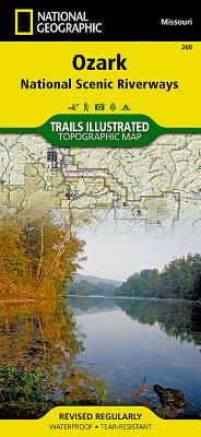
Ozark National Scenic Riverways Map (National Geographic Trails Illustrated Map #260)
Current price:
$14.95
Publication Date: January 1st, 2019
Publisher:
National Geographic Maps
ISBN:
9781566953597
Pages:
2
Description
- Waterproof - Tear-Resistant - Topographic Map
Explore the beauty and serenity of the Current and Jacks Fork rivers as they meander through southeastern Missouri's Ozark Mountains with National Geographic's Trails Illustrated map of Ozark National Scenic Riverways. Created in partnership with local land management agencies, this expertly researched map delivers unmatched detail and helpful information for experienced outdoor enthusiasts and casual visitors alike. Key areas of interest featured on this map include Montauk State Park, Roger Pryor Pioneer Backcountry, Pioneer Forest, Angeline Conservation Area, Mark Twain National Forest, Stegall Mountain, and Peck Ranch.
This map can guide you off the beaten path and back again with miles of mapped trails including a portion of the Ozark Trail. Trail mileage between intersections will help you choose the path that's right for you. River mileage is noted as well, for those exploring by boat. Select trail summaries, safety tips, and information about many recreational opportunities available in the region including hiking, hunting, fishing, canoeing, horseback riding, spelunking, and more will help you make the most of your visit. The map base includes contour lines, shaded relief, and elevations for summits and passes. Many recreation features are noted as well, including campgrounds, boat launches, river access, trailheads, interpretive trails, shooting and archery ranges, interpretive drives, and points of interest.
Every Trails Illustrated map is printed on "Backcountry Tough" waterproof, tear-resistant paper. A full UTM grid is printed on the map to aid with GPS navigation.
Other features found on this map include: Mark Twain National Forest, Ozark National Scenic Riverway, Spring Valley.
Map Scale = 1:63,360Sheet Size = 25.5" x 37.75"Folded Size = 4.25" x 9.25"
Other Books in Series
Glacier and Waterton Lakes National Parks Map (National Geographic Trails Illustrated Map #215)
Folded
Death Valley National Park Map (National Geographic Trails Illustrated Map #221)
Folded
Zion National Park Map (National Geographic Trails Illustrated Map #214)
Folded
Camino de Santiago West Map [Map Pack Bunde] Map (National Geographic Trails Illustrated Map)
Folded
Grand Teton National Park Map (National Geographic Trails Illustrated Map #202)
Folded
Yellowstone National Park Map (National Geographic Trails Illustrated Map #201)
Folded
Acadia National Park Map (National Geographic Trails Illustrated Map #212)
Folded
Grand Canyon, North and South Rims Map [Grand Canyon National Park] (National Geographic Trails Illustrated Map #261)
Other
Yosemite National Park Map (National Geographic Trails Illustrated Map #206)
Folded
Olympic National Park Map (National Geographic Trails Illustrated Map #216)
Folded
Great Smoky Mountains National Park Map (National Geographic Trails Illustrated Map #229)
Folded
Mount Rainier National Park Map (National Geographic Trails Illustrated Map #217)
Folded
Baxter State Park Map [Mount Katahdin, Katahdin Iron Works] (National Geographic Trails Illustrated Map #754)
Folded
Lake Placid, High Peaks: Adirondack Park Map (National Geographic Trails Illustrated Map #742)
Folded
North Cascades National Park Map (National Geographic Trails Illustrated Map #223)
Folded
Rocky Mountain National Park Map (National Geographic Trails Illustrated Map #200)
Folded
Isle Royale National Park Map (National Geographic Trails Illustrated Map #240)
Folded
Northville, Raquette Lake: Adirondack Park Map (National Geographic Trails Illustrated Map #744)
Folded
Big Bend National Park Map (National Geographic Trails Illustrated Map #225)
Folded
Bryce Canyon National Park Map (National Geographic Trails Illustrated Map #219)
Folded